This is a subscription only section
Want to read more? It's only €10/year.
No account yet? Just Create an account first and head to the shop
| ICAO Code | TNCC/CUR |
| Last Validated | 03-2019 |
| City | Curaçao |
| Position | 12°11'20"N 068°57'35"W |
| Runway(s) | 11/29 |
| Elevation | 29 ft |
Hato is the largest airport of the Dutch Caribbean and is located on the north coast of Curaçao, the largest island of the Kingdom of the Netherlands. International flights include European and American airlines and smaller regional carriers. Cargo flights and general aviation make up the civil presence. Because of its runway length and strategic location just off the South American mainland, Hato was chosen as a Forward Operating Location (FOL) by the US military, resulting in a presence of American military aircraft. The Dutch government is represented by the Duct Caribbean Coast Guard.
North side
The north side of the airport is adjacent to the Caribbean Sea, neither facilities nor viewing spots can be found here.
South side
The south side of the airport is where it all happens. From left to right you will find the US FOL, the coast guard facilities, cargo apron, the domestic and international aprons and the general aviation area.
Without a ferry connection to the South American mainland or any other island, Hato airport is the main gateway to Curaçao and most likely your point of entry. Coming from the capital Willemstad, head northeast on the Pater Euwensweg. After passing Julianadorp on your right you will find yourself on a large roundabout, take the second road on your right to the airport.

Spot 1 is one of many excellent spots at Hato. Wim Sonneveld
Another great spot, although a bit harder to find is spot 2. Wim Sonneveld
| 118.300 | Tower |
| 250.000 | Iguana Ops |
| 240.200 | Dutch Ops |
| 119.600 | Approach |
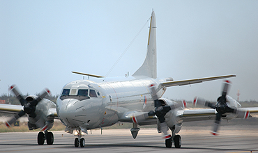
| Dutch Caribbean Coast Guard | AW139, DHC-8-102MPA |
| US FOL | various types on tdy |
| Divi Divi Air | B737, BN-2, DHC-6 |
| EZ Air | Beech 1900, BN-2, Learjet |
| 203/H | This ex-MLD SP-2H is used by the fire brigade near the 29 threshold. |
| Hato Flight Info | Flight Info for Hato Airport |
| Dutch Caribbean - Coast Guard |
| Aruba - Reina Beatrix | |
| Bonaire - Flamingo | |
| Curaçao - Hato | |
| Saba - Juancho E. Yrausquin | |
| St. Eustatius - F.D. Roosevelt | |
| St. Maarten - Princess Juliana |
As a member you get access to all our
premium content and benefits learn more